Saturday, 5 November 2016

Honduras - Land of the Dodgems

Our last night in El Salvador was spent in the little town of La Palma, just a stone's throw from the border with Honduras. La Palma is known for its artwork and many of the buildings are decorated with a very particular stylised form of bright painting which we found most attractive.

Ethnic wall art, La Palma, El Salvador

Ox Cart, El Salvador

This is how they dry the maize in parts of El Salvador and Honduras

The border crossing into Honduras on Tuesday 18th October was the most tedious we have experienced so far. Exiting from the El Salvador side was very straightforward (as it had been when we entered) but once we got through to Honduras then things changed down several gears. The final part was for the importation of the vehicle and involved being passed through several people, then a chap having to fill in about 15 forms, all in long hand, but he still needed to refer to his computer which kept breaking down. The whole process took two hours but at least everyone was good humoured!

Our first night in Honduras was spent in the town of Santa Rosa de Copan, some 50 miles from the border, and then we set off on Wednesday for Copan Ruinas.

The roads here are interesting. In England, of course, we drive on the left and in most of Central America they drive on the right. In Honduras they drive on both sides of the road. The reason for this is that there are so many huge potholes and people avoid them by suddenly swerving over onto your side of the road when they're a couple of hundred yards away. Sue did not enjoy this phenomenon!

Copan Ruinas is a charming town in the hills just east of the border with Guatemala and, as its name implies, very close to the Copan archaeological site. We spent the best part of four days here.

Naturally we visited the ruins, apparently one of Central America's major Mayan centres and yet another World Heritage Site. They are particularly good on the deep bas relief carved stelae showing their rulers in various impossible postures and there was also a very impressive hieroglyphic stairway. There are a number of unexcavated buildings which are still buried in jungle and give an atmospheric feel to the place.

Carving of Mayan Chief, Copan

Carving of Mayan chief looking more like a Chinaman

Ball court, Copan

Pyramid of the Skulls

Serpent head carving

Scary torch bearer

Unexcavated ruin

Intricate carving of bird and fish

The high point as far as we were concerned was the abundance of scarlet macaws. The scarlet macaw is the national bird of Honduras and there is a breeding/release programme in this area which is why there were so many. Alan was particularly delighted and quickly got his telephoto lens out - he's been missing his birds!

Pair of Scarlet Macaws at Copan archaeological site

Pair of Scarlet Macaws

Alan was up at 5 am on Friday morning to go out with a local ornithologist for a few hours. They saw a huge abundance of birds but they were all too far away for Alan to photograph (Cal will be disappointed). We also visited Macaw Mountain which is a bird park and nature reserve specialising in the the rehabilitation of birds, particularly scarlet macaws, that have been either confiscated from private owners or given up voluntarily.

Copan River in the early morning

Pensive peasant farmer, Copan Ruinas

We left Copan Ruinas on Sunday 23rd October and made our way eastwards to Lago Yojoa, one of the largest natural lakes in Honduras. We found a really lovely place to camp in the grounds of a beautiful bio-park and coffee farm. There were a number of very beautiful trees and shrubs, small swimming pools, and a river which looked like a smaller version of the River Dart, quite bumpy and noisy with lots of rocks. There were also some giant bamboos, the like of which we're never seen before. We camped in a little clearing in the trees and the sound of the rushing river sent us off beautifully to sleep.

Campsite at Finca Paraiso, near Lago Yojoa

River at Finca Paraiso

Large spider

Small person, very large bamboo

On Monday we went in search of the lake which we found by means of kayaking from a very pretty canal which feeds into the lake. The canal didn't look like a canal at all, it had reeds at the sides and quite a lot of bird life and fishes skittering around and we paddled some little way to the lake and then turned left. In the distance we saw a collection of roofs and what looked like a bridge so, in the hope that it might turn out to be a restaurant, we set off in that direction across the lake. It turned out to be a little hotel complete with a restaurant where we had a very nice lunch before setting off back across the lake. A total of three hours paddling so we felt we'd had a bit of much needed exercise.

View of Lago Yojoa from the top of the hill at the campsite

On the road again on Tuesday to make our way to the coastal city of La Ceiba in the north. A long but uneventful journey although Alan had to have his wits about him the whole time due to the seriously deranged Honduran drivers who don't follow the normal rules of the road and are quite unpredictable.

Our main reason for coming to La Ceiba was to make the crossing to the Bay Islands for some diving and snorkelling. La Ceiba itself doesn't have much to recommend it, we found it to be untidy and rather smelly and all the streets are full of rubbish and/or water and it has a generally shambolic appearance. However, we pottered around on Wednesday, having found out about ferries to the islands, and visited a little village further along the coast where there was a nice little restaurant right on the ocean and some thermal springs nearby which Alan flopped around in for a while.

The delights of downtown La Ceiba

Fisherman with a very good sense of balance

Butterflies having happy times on our windscreen

Canoes at La Ceiba beachfront

We stayed at a nice place called Casa de Espana which was run by a delightful chap called Pablo who couldn't do enough to be hospitable. He allowed us to park Lucy in the yard at his house, cooked us a very nice meal of garlic prawns on Wednesday evening and drove us to the ferry port on Thursday morning.

The ferry trip to Roatan, the largest of the Bay Islands, took one and a half hours and then we set about hiring a car and finding somewhere to stay. Roatan is about 40 miles long, running East to west, and 3 miles wide with only one main road so it didn't take us long. We found a nice little hotel on the north side of the island at West End immediately overlooking the sea.

The Caribbean Sea was not in good humour. For our entire stay it was crashing against the coral on the shore in front of the hotel and throwing up large columns of spume with the spray frequently reaching our first floor balcony. However, we enjoyed going to sleep with with the door to the balcony open and the sound of the waves as accompaniment.

How the other half like to travel

Caribbean behaving like the North Atlantic

We spent four days on the island. There was a very good Botanical garden with a lot of specimen trees and shrubs where we saw some beautiful flourescent green humming birds. It had a trail that went off up what they rather grandly called a mountain but was actually something between a pimple and a hill. It was however quite a nice stroll up through the forest area and when we came out on the top there was a wonderful view over the northern part of the island.

View from the top of the hill, Roatan

View from the top of the hill showing the reef, Roatan

Sue in grove of palm trees, Botanical Gardens

Very busy leaf cutter ants

Emerald humming bird

Humming bird picking its nose

The Western end of Roatan is quite well developed for tourists but the Eastern end is much more remote with beautiful views from coast to coast which we could see from the road on the island's hilly interior. We had a look at the fishing village of Oak Ridge with all its wooden houses built on stilts around the edge of the harbour but we didn't find the locals very welcoming. So we left there and drove our little hire car along a dirt road (with Alan occasionally forgetting we were not in Lucy as we bounced over pot holes) until we came upon a little restaurant fronting a classic deserted Bounty Bar beach.

Market at Coxon Hole, Roatan

View of North of Roatan Island

Sheep grazing (but what on??), Oak Ridge harbour

Ship wreck from Hurricane Mitch (1990's), Oak Ridge harbour
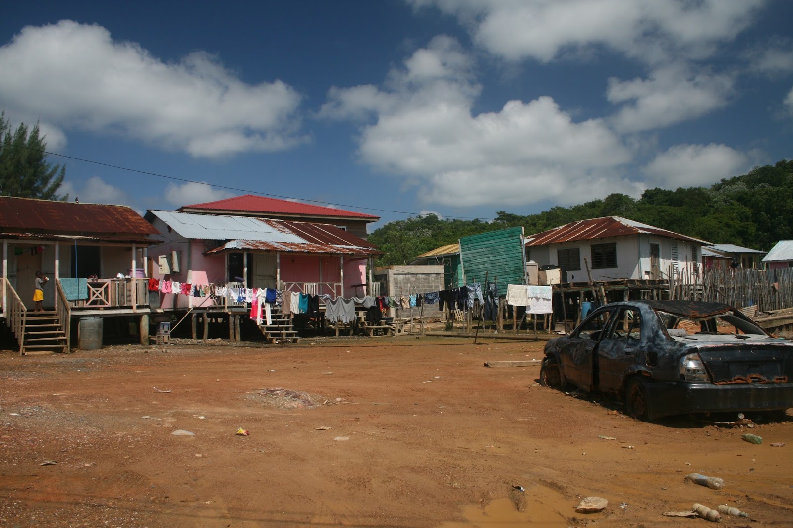
Local houses, Oak Ridge

Washing day, Oak Ridge

Home sweet home, Oak Ridge

Slightly battered home, Oak Ridge

Classic Bounty Bar Beach, Roatan

Alan finally got his diving trip on Sunday although the weather was too rough for Sue to go snorkelling. There were seven other people booked to go on the dive trip but in the event all the others cried off because of the poor weather, leaving Alan to have a dive boat and dive master all to himself.

He had two dives and saw a lot of interesting fish but the main attraction for him was the beautiful coral and sponges, of which there were many different varieties of all shapes and colours.

Our stay on Roatan provided a very relaxing respite from the travelling and needless to say, we ate a lot of wonderful seafood whilst we were there. Alan had lion fish for the very first time and pronounced it to be excellent. Lion fish have become somewhat of a nuisance in this part of the Caribbean as they are aggressive predators of other fish and there is a general campaign to try to reduce their numbers, mostly by serving them up in restaurants!

Sunset from our hotel balcony, Roatan

Wreck, Roatan

We got the ferry back to La Ceiba on Monday 31st October and dear old Pablo and his wife met us as they had promised and brought us back to their hotel.

The rain started in ernest at about four o'clock and continued until we went to bed. The road outside the hotel which has a kerb of about six inches soon was a river and shortly after that the footpath itself was under about six inches of water. Most vehicles were turning round at what was now a lake but we watched a cyclist with a child on the front of his bike who peddled manfully through about eighteen inches of water.

The Pico Bonito National Park, the largest national park in Honduras, is very close to La Ceiba, so we decided to take a look on Tuesday. We followed the Rio Cangrejal until we came to a hut where we paid a dollar each to access the park via a hanging bridge high across the river. A strenous but satisfying walk took us up and up on a rocky track through some very jungly stuff to a very impressive waterfall and then back down on a different path, three and a half hours in total to complete the circuit. It definitely wasn't a little stroll in the park.

View of waterfall from the road, Pico Bonito National Park

Hanging bridge, Pico Bonito


Looking at the waterfall and spray from below

The old man cooling off in the spray from the waterfall

The Rio Cangrejal is supposed to be a mecca for white water rafting and kayaking but we didn't see any and Alan said that the white water (which was actually a very muddy brown) was probably about a grade 5 and above even his pay grade.

We left La Ceiba on Wednesday to drive back south and stopped again at Lago Yojoa at the beautiful campsite where we had stayed on the way up to the coast. Unfortunately, we discovered that the mattress and duvet were soaking wet so we could not camp after all. We are not sure how the interior of the tent got quite so wet but there was a great deal of torrential rain whilst we were on Roatan and Lucy was parked at La Ceiba, so we guessed it seeped in under the tent cover somehow and through the fold in the tent floor. The only other accommodation they had to offer us was a cabana for 7 people which cost us $100 US instead of $5 to camp!

We got on the road again on Thursday morning and drove to Comayagua, the old capital of Honduras, where we stopped for the night. In an effort to get the tent dry inside we erected it in the hotel car park, much to the bemusement of the security guard.

Today is Friday 4th November and we have had a very long drive to Choluteca, a town without any redeeming features other than it is about 40 kilometres from the border with Nicaragua. We conducted a little survey between ourselves on the way here and have ranked the Hondurans in first position for being the most dangerous drivers we have encountered on our trip so far. Alan is currently enjoying a well earned beer after five hours solid driving on these awful roads.

All being well we will cross the border into Nicaragua tomorrow. We also hope that we are finally coming into the dry season in this part of the world, it's about time!

Monday, 17 October 2016

On top of the Volcano (a different one)

Our crossing into El Salvador on Saturday 8th October was the easist we have had so far and we managed to get through immigration, passport control and vehicle check, all in a little over half an hour.  All the officials were unfailingly polite and seemed genuinely pleased that we had come to El Salvador to see their country, a very positive start.

Welcome to El Salvador!

We made our way to the little town of Juayou on the 'Ruta de las Flores' which seemed a good place to base ourselves and checked into a very pleasant little hostel called Casa Mazeta.

The highland scenery in this area is quite dramatic which we discovered whilst driving around on Sunday. We savoured the delights that nearby towns and villages had to offer, including food festivals, street markets, brightly painted buildings and local handicrafts.

Market day at Ataco

Wall painting and dancing puppet

Musicians in the plaza

Vendor at Ataco food festival

On Monday we went on a walk with a local guide, Carlos, plus his nephew, plus the family pack of six dogs.

Carlos, Sue and dogs on the way to the waterfalls

This took us out of the town, through coffee plantations to a series of waterfalls. These form part of a hydro-electric scheme and some of them issue into small containment pools which you can swim in. Not only that but they are connected by tunnels and Alan, being Alan, wanted to go through them.

Alan at the waterfall

Alan in the waterfalls - just before the tunnel

The tunnels were only about three to four feet across and the flow through them was quite fast. There was very little clearance above the water and at one point only about 3 inches so he had to float through holding his breath. Towards the end of the second tunnel the water and the tunnel took a sharp dive downwards towards the turbines. Luckily there was a window on the right out onto a rock ledge that they could get out onto to save them from being scrambled in the turbines.

Needless to say, both Alan and Carlos came out buzzing at the other end and clearly enjoyed the adrenalin rush. Carlos said Alan was 'bueno', Sue said he was a 'poco loco'!

The glow of satisfaction after the tunnels!

We also went in search of the Ceiba de los Pericos, a 600 year old tree which the guide book informed us was home to several hundred parrots. After asking directions from numerous people we finally found it, a very fine tree it was too, but there was not a parrot in sight. Apparently they have all flown to who knows where. Ah well.

On Tuesday we went to the Parque Nacional el Imposible. This involved driving to Tocuba, a town some 30 kilometres away and then arranging for a park guide at the local hostel. Sure enough, after about half an hour a guy came along who said he could take us into the park and we folded him neatly into the tiny back seat of Lucy. This was when we discovered why the park is called 'El Imposible'.

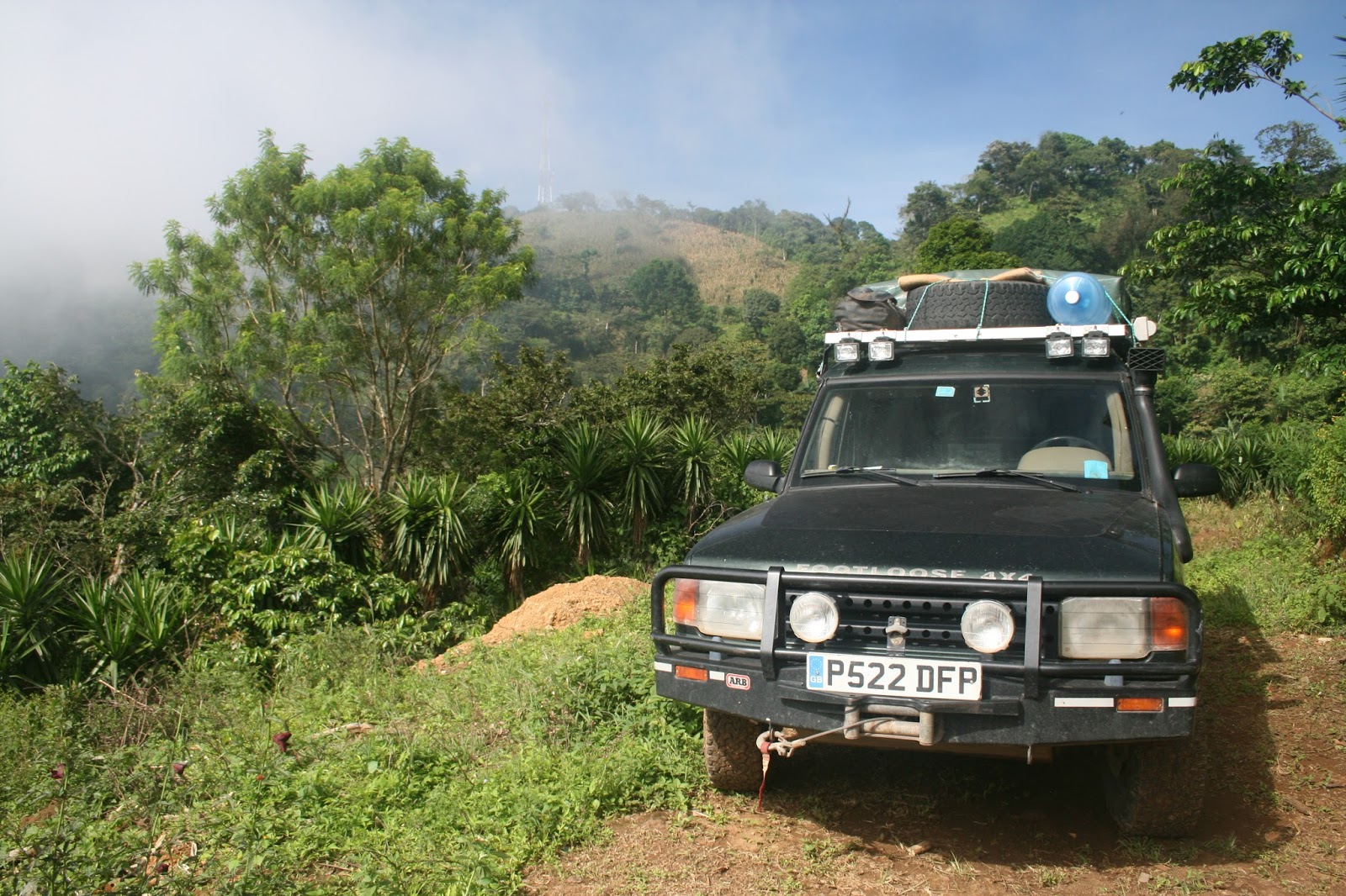
We both agreed that the road into the park was the worst that we have ever experienced. The road down to the Copper Canyon in Mexico was scarier, largely because of the massive drops without any intervening vegetation along the sides of the road, but this road was much, much steeper, much narrower, and much more rocky and Alan finished up driving both up and down in bottom gear, low ratio with the Diff Lock on.

Lucy at the top

After about 45 minutes of this impossible road we reached our guide's parents' house and then set off up the hill through their coffee plantation.

Walking through the coffee plantation

Before too long we reached the top of the mountain with the most stunning 360 degree view right across to the Pacific Coast 45 kilometres away and over to Guatemala and it felt just like we were on top of the world!

Sue on top of the world

We then trotted back down the hill and went to our guide's parents' house where there was a variety of small children, family members, two dogs and a puppy. There was a verandah looking out over the valley and they brought us oranges to eat which were very sweet.

Mother and child

Bath time

Then we set off back down the murderous road by which we had come and although it was no easier on the way back at least we knew what we were in for.

Fellow traveller on the road

Wednesday was a bit of an exploration day in the Cerro Cerde National Park, apparently one of El Salvador's finest natural attractions where there are three volcanoes. We made our way first to Lago de Coatepeque, a huge but quite beautiful crater lake where we had a very nice lunch at a roadside restaurant looking out over the lake. By the time we reached Cerro Verde it was mid afternoon and too late to do much exploring but we found a good place to camp the following day.

Lago de Coatepeque

Lunch overlooking the lake

Car wash, El Salvador style

And that is exactly what we did. We left Juayua on Thursday morning and made our way to Campo Bello on the slopes of Cerro Verde. We pottered around there and went on a little nature trail around the Cerro Verde summit with views across to Santa Ana, El Salvador's highest volcano, and Izalco, a geologically young volcano which only became active in the 17th century.

View of Lago de Coatepeque from Cerro Verde

Campsite at Campo Bello

Alan at Campo Bello with Volcan Izalco in background

One of Alan's arty shots - Campo Bello

On Friday we climbed Santa Ana! We thought we would be going with a guide but, in the event, at least a hundred other people turned up for the trek (most of them in their twenties) and we all trooped up together accompanied by 3 or 4 guides and 2 tourist policemen, complete with stun grenades and 45 calibre colt automatic pistols.

It took us two hours of reasonably steep climbing to get onto the summit where a massively dramatic sight awaited us. Santa Ana is a volcano that has been fairly active recently and it has a wide crater at the bottom of which is an acid green lake composed largely of sulphuric acid. Periodically there were bubblings and gurglings coming up through the surface of the lake. The view from the top was stunning. Not only did we have the caldera with its poisonous lake but turning round in the other direction we had wonderful views of Izalco, Cerro Verde and Lago de Coatepeque.

Sue having a much needed rest at the top of Santa Ana

Acid crater lake, Volcan Santa Ana

Volcan Izalco covered in cloud

View of Lago de Coatepeque from Santa Ana

Arty shot with aloe - on the way back down

We set off from Campo Bello in good order on Saturday morning and made our way to the small town of Suchitito in the north of El Salvador.

On the way we stopped off at a place called Joya de Ceren. This has been designated a UNESCO World Heritage Site, the only one in El Salvador, and we found the place fascinating. Basically it is a village of ordinary Mayan people that was buried under about 6 metres of volcanic ash after an eruption about 1500 years ago. It was not covered so quickly that the people didn't have a chance to escape but they didn't take their goods and chattels with them. There are a number of dwellings, storage buildings, kitchens, meeting houses and a sauna, all preserved by the volcanic ash.

Excavated dwelling house, Joya de Ceren, showing mud and wattle building technique

Shaman's house, Joya de Ceren

Excavated dwelling

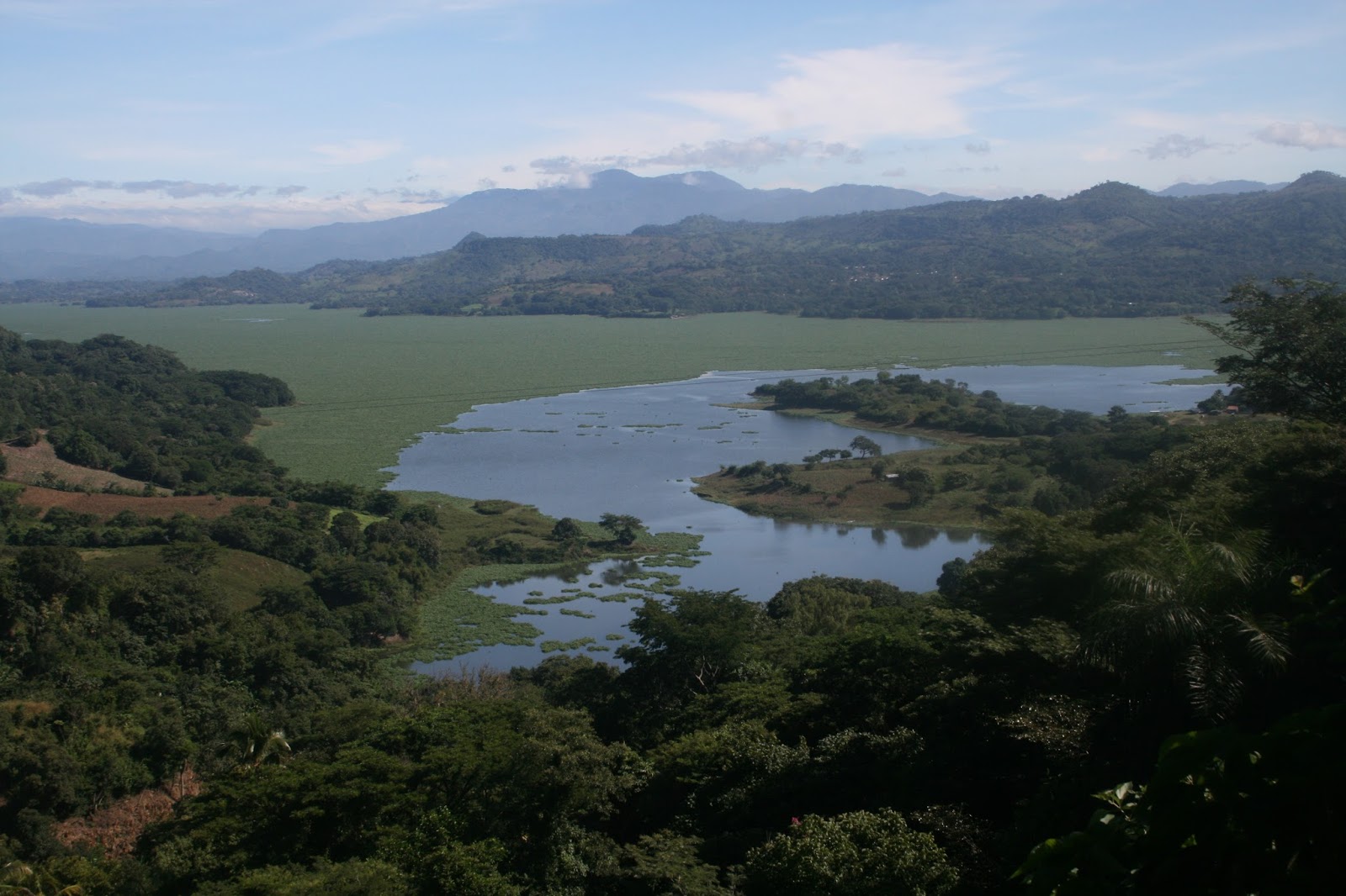
Suchitoto is an attractive little town with cobbled streets and an intersting church. It sits beside a large reservoir and we are staying at a nice little hotel with a balcony overlooking the lake. Unfortunately, the lake is almost entirely covered in water hyacinth which constantly changes its configuration. Whilst we are told there is wonderful bird life out there, we can't see it because boats cannot get through the stuff.

View of lake from hotel balcony

View of lake showing changed position of water hyacinth

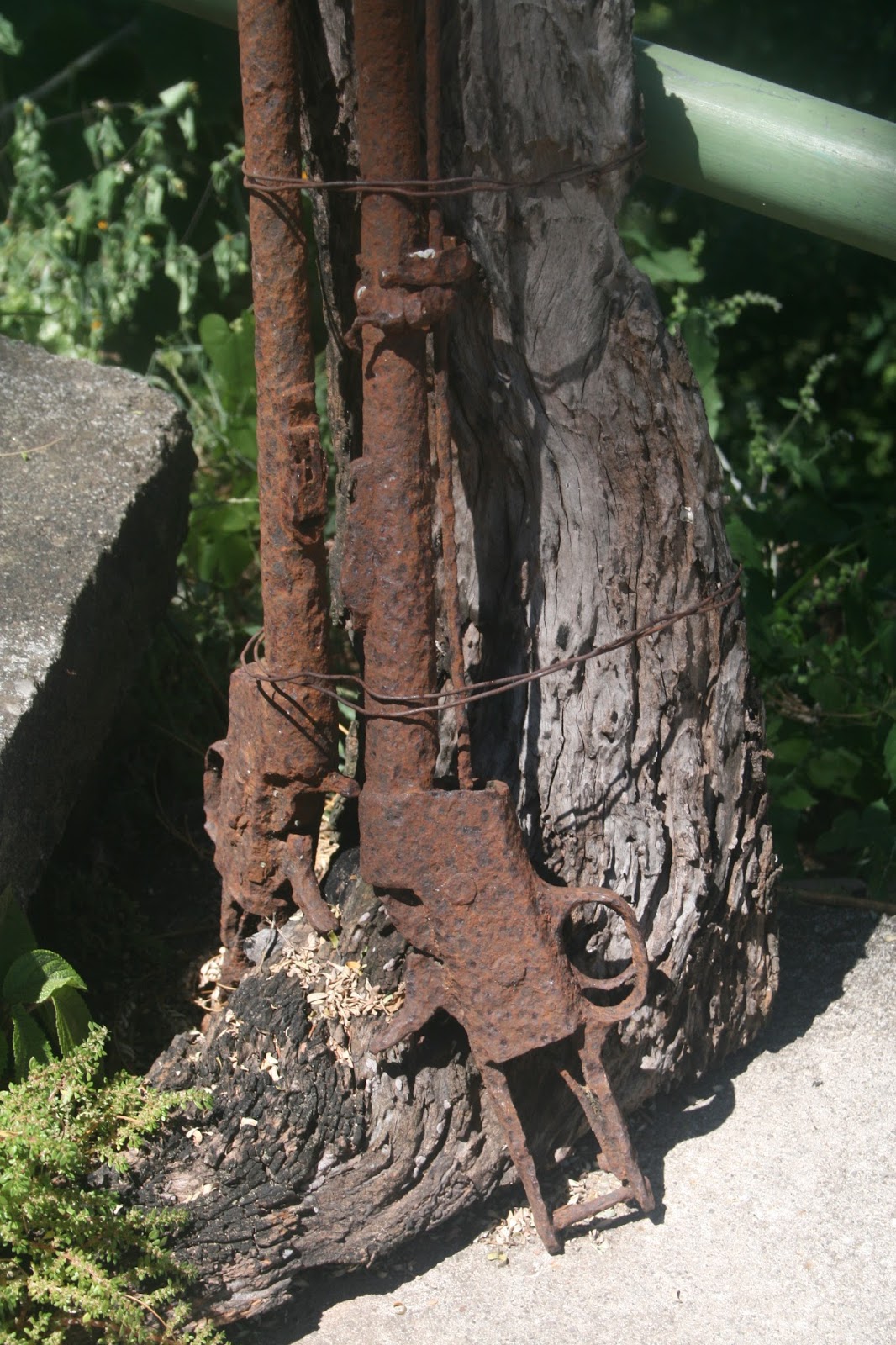
Old saddle carbines, long defunct

We had a rude awakening at five o'clock this morning by very loud music coming from the house next door to us. Apparently it is somebody's birthday and in this part of the world birthdays start very early. So we were treated to a great deal of sentimental El Salvadorian music followed by 'Happy Birthday'.

Cattle grazing on water hyacinth

Farmer feeding cattle on the lakeside

Storm approaching over the lake

Tomorrow is Monday 17th October and we and we will have been on our travels for exactly six months! We will be heading to La Palma, a small town close to the border with Honduras, with the intention of crossing the border on Tuesday morning.

Although we have only been here just over a week we have formed a very positive impression of El Salvador. It is the smallest country in Central America and the most densely populated. It also has the unenviable reputation for having the highest level of violent crime and there has certainly been a large police presence everywhere we have visited. However, all the people we have encountered have been really friendly and helpful and genuinely pleased that we have visited their country.